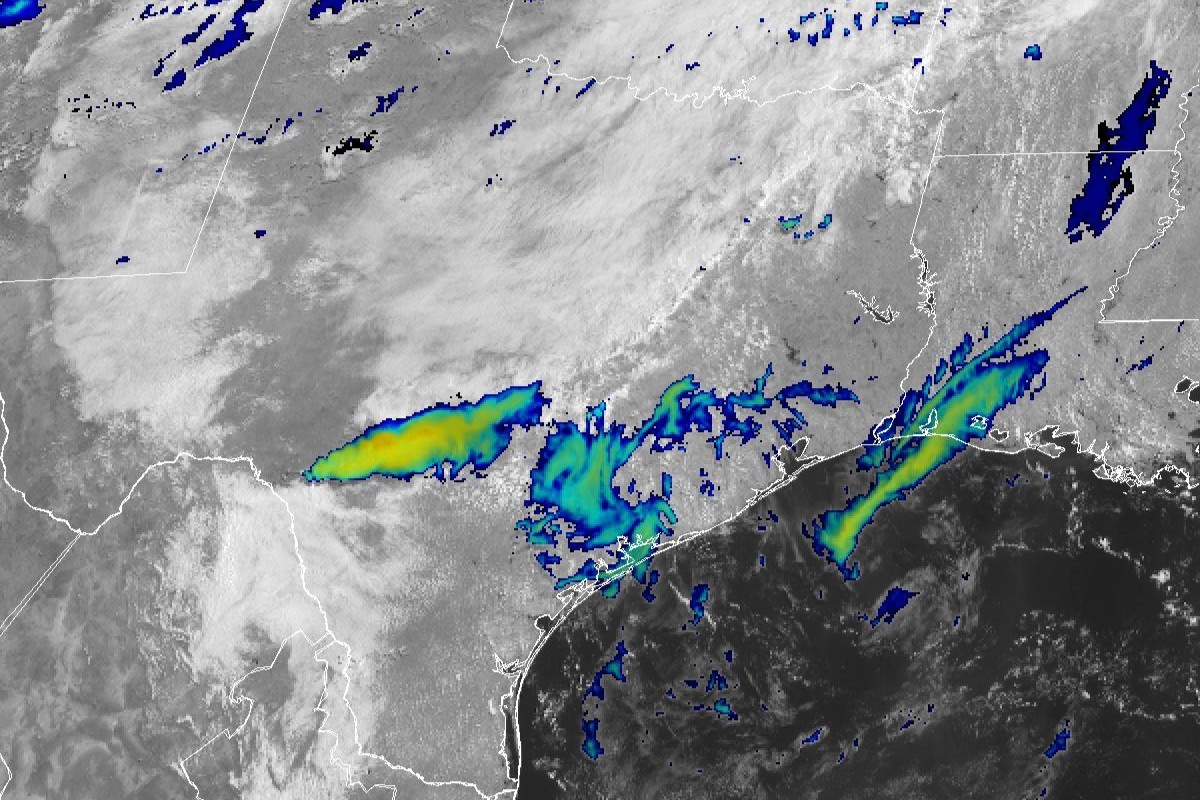
How do weather satellites keep Texas safe? Here's the science happening 23,000 miles up

Every hurricane season , we become familiar with the counterclockwise-spinning spiral as the near-universal symbol for the storms. But that wouldn't have been possible without weather satellites to tell us what those storms look like from the outside.
Imaging tools on satellites positioned tens of thousands of miles above the Earth's surface do more than provide illuminating photography, though. They also play a crucial role in predicting and tracking potentially life-threatening weather conditions.
HURRICANE ALERTS : Be prepared for hurricane season. Sign up for our free text messages
It's true that when it comes to television forecasts or monitoring severe weather on your smartphone app, the visuals you might see first are the vivid but pixelated images captured by Doppler weather radar, which shows clouds in varying colors, depending on how much rainfall was reflected by the radar signal.
However, the computer forecast models that meteorologists rely on daily to predict the weather are based on data collected by two types of weather satellites: geostationary and polar orbiting. These satellites are operated by the federal government's top weather agency , the National Oceanic and Atmospheric Administration, in partnership with spacecraft experts at the National Aeronautics and Space Administration.
"As the potential for severe thunderstorms, hail, tornadoes, dangerous lightning, and flooding increases, NOAA satellites work together to provide critical data for weather forecasts and severe weather warnings," according to the National Environmental Satellite, Data and Information Service website. "They also aid emergency responders to help keep our communities safe."
Geostationary satellites stay over one spot
NOAA's Geostationary Operational Environmental Satellites, or GOES , are positioned about 22,000 miles above Earth. They travel at the same speed and direction as the planet's rotation, which allows them to remain fixed over specific regions. This enables continuous, round-the-clock monitoring of the Earth's Western Hemisphere.
GOES are considered the most advanced weather-observing satellites as they provide nearly real-time data on certain cloud features that signal a strengthening thunderstorm or the development of a tropical system in the Atlantic or Pacific Ocean. They also are capable of tracking wildfire smoke or dust and volcanic plumes , which can diminish air quality and visibility.
GOES are equipped with a special instrument called the Advanced Baseline Imager. It can detect gravity waves and cumulonimbus cloud features called overshooting tops and above-anvil cirrus plumes, which are signs that a thunderstorm may have reached severe status. These satellites can provide updates over a specific area as frequently as every 30 seconds, allowing forecasters to closely monitor rapidly evolving storms, according to NOAA.
The satellites also deliver crucial data on cloud heights and temperatures. For instance, GOES can discern colder cloud tops, which indicate a higher likelihood of hail and intense rainfall. A satellite's onboard ABI will feed that information into an algorithm, which then estimates rainfall rates in a storm.
This has been a huge game changer in flood-prone areas in Texas like Austin, San Antonio and Houston. This kind of information has been used to create comprehensive flood zone maps that are then provided to the Federal Emergency Management Agency , local emergency officials and first responders to help them quickly determine their course of action during a flood event.
Another instrument on a GOES satellite is the Geostationary Lightning Mapper, which tracks lightning activity and measures the size and distance of flashes. During a strong thunderstorm, a rapid increase in lightning can signal high levels of energy, potentially leading to large hail, damaging winds, or tornadoes. This valuable tool helps forecasters assess storm threats and provide timely warnings to construction crews, lifeguards, landscapers, attendees of outdoor sporting events or anyone at risk of being struck by lightning.
Polar-orbiting satellites circle the globe
The second type of satellite system is NOAA's Joint Polar-Orbiting Satellite System , which circles the Earth, pole to pole, twice a day. These satellites provide information for weather prediction models that produce three- to seven-day forecasts for severe weather events. Around 85% of the data that go into forecast models comes from these polar-orbiting satellites, whose instruments measure temperature, water vapor and wind speeds throughout the atmosphere, according to NESDIS.
"These forecasts allow for early warnings and enable emergency managers to make timely decisions to protect American lives and property, including ordering effective evacuations," NESDIS explains on its website.
This year, NOAA and NASA are celebrating 50 years of the remarkable legacy of GOES Satellites. NASA emphasized the importance of these "eyes in the sky," which play a vital role in safeguarding the 1 billion people living and working across the Americas. Meanwhile, efforts are already underway to develop the next generation of GOES satellites in 2030.
There’s more to Houston with the Chronicle. Subscribe today for just 25¢.
Post a Comment